Thissio- Faliro (SNFCC)
The bike path that connects Thissio with Faliro, i.e. the historic centre with the sea.


Location
Timeline
Modern and Contemporary era (1821 - )
2015 Constructed.
The bike path that connects Thissio with Faliro, i.e. the historic centre with the sea.
Home > Athens > Activities > Cycling > Centre > Thissio- Faliro (SNFCC)
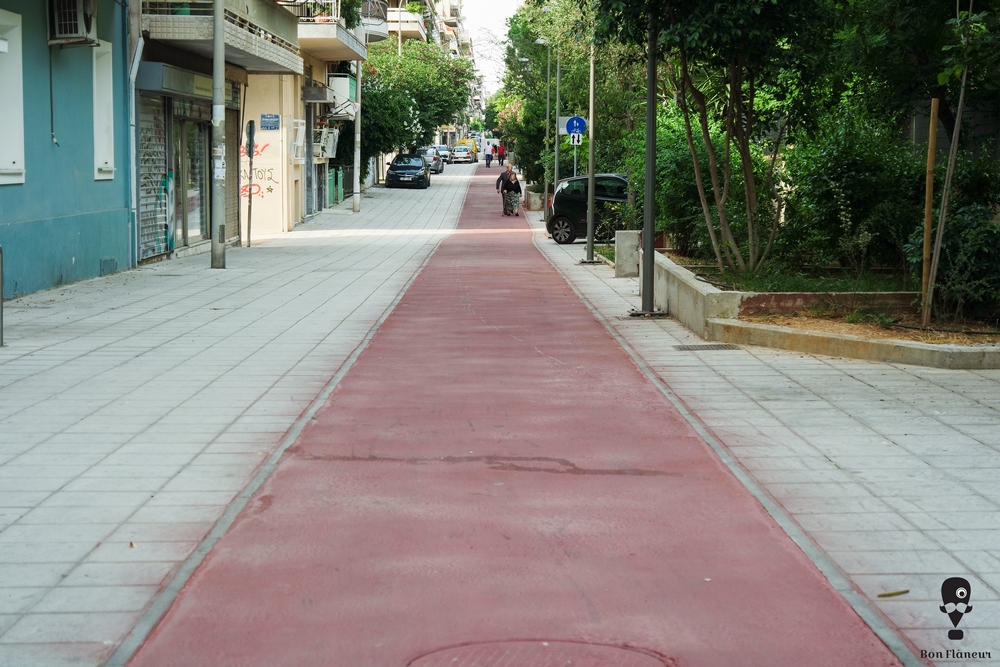
It is an easy cycling route of about 6.5 km which passes through many southern neighbourhoods before reaching the Stavros Niarchos Foundation Cultural Centre and continuing along the coast. From Thissio up to the Technopolis there is cobblestone, which is not very friendly for bicycles. From that point, however, there is a regular bike path all the way to the cultural centre. The only exceptions are the pedestrian street at the Petralona metro station and another point in Kallithea area, where a broken line indicates that pedestrians have priority. Throughout the route, we will meet many absent-minded pedestrians walking on the bike path. The route is partly in green or more “urban” areas, and a large part of the route is parallel to the Ilissos River. At Lambrou Katsoni Street, in the Moschato area, we have to cross the pedestrian bridge of Ilissos to continue to the cultural centre, otherwise we end up on Poseidonos Avenue.
It is the largest institutionalized bike path in the city so far, and was intended to connect the sea and the centre with northern Athens. There have been many studies on developing a complete bicycle network in the city, but none has ever been implemented, making Athens an inhospitable city for cycling. Efforts are being made to reverse this situation, however, especially after the Covid-19 era.
Field observation by scientific editors
2015 Constructed.

Share