Vardari (Dimokratias) Square/ Vardaris district
The Dimokratias Square has changed many names, but the people of Thessaloniki always call it "Vardari".

The Dimokratias Square has changed many names, but the people of Thessaloniki always call it "Vardari".
Home > Thessaloniki > History and Archaeology > Centre > Byzantine period > Vardari (Dimokratias) Square/ Vardaris district


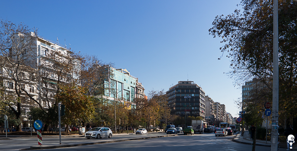
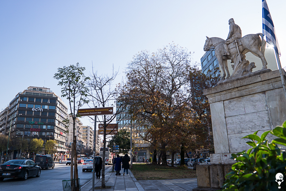
You wouldn’t know Dimokratias (=Democracy) Square was a square, if you visited it these days. The construction works for the metro have completely changed the character of the area and the emblematic sculpture of King Constantine, the leader of the Greek army when the Turks surrendered the city to Greeks, is temporarily hidden deep into the south side of Egnatia Street. The area around Vardari Square is of interest also. To the west, we find Chinatown, while further down, towards the courts, we see the Ottoman central city building (Top Hane), built in 1546, when the Sultan Suleiman the Magnificent stayed in the city for a few months. Anaglyfou Tower, in the eastern part of the fortress, is Byzantine (862 AD).
It has changed many names (Myedan Yakik Manastir, Ioannis Metaxas, Vardar, Alexander Svolos, Dimokratias), but Thessalonians now call it Vardari. The name is also mentioned in literature and it is a corruption of the Hungarian “Bar Daria”, meaning “Great River”. The Byzantine Emperor Fokas had imprisoned Hungarians in Yannitsa, next to the Axios river, who referred to their prison by this name. The square was lively and busy for centuries. In Roman times, the Golden Gate was located there, one of the western entrances to the city, crossed by Egnatia Street. The Thessalonians tried to escape from the Golden Gate, during the conquest by the Saracens in 904. In the Ottoman period, there were many inns here, which no longer exist. Both during the Ottoman and interwar periods, it was a hub for shopping and leisure. Most of the city’s brothels were found here, with frequent violence between pimps, which often had tragic endings. On the corner of Moskov Street and Dimokratias Square was the former National Security building, where political prisoners from the civil war until the colonels’ junta were imprisoned, tortured and killed.
Zafeiris Ch., (1997), Θεσσαλονίκης Εγκόλπιον, ιστορία, πολιτισμός, η πόλη σήμερα, γεύσεις, μουσεία, μνημεία, διαδρομές, [Thessaloniki Handbook, history, culture, the city today, flavours, museums, routes], Athens: Exantas
Kourkoutidou- Nikolaidou E., Tourta A., (1997), Περίπατοι στη Βυζαντινή Θεσσαλονίκη, [Walks in the Byzantine Thessaloniki], Athens: Kapon publications
Serefas S., Petridis P., (2012), Εδώ: Τόποι βίας στη Θεσσαλονίκη, [Here: Places of violence in Thessaloniki], Agra
Stefanidou- Tiveriou Th., (2020), Θεσσαλονίκη, όψεις μιας αρχαίας μητρόπολης, δώδεκα αρχαιολογικά κείμενα, [Thessaloniki, aspects of an ancient metropolis, twelve archaeological texts], University Studio Press
Tomanas Κ., (1997), Οι πλατείες της Θεσσαλονίκης μέχρι το 1944, [The squares of Thessaloniki until 1944], Thessaloniki: Nisides
Toulas G., (2013), Ο χάρτης της πόλης: Πλατεία Βαρδαρίου, [City map: Vardari Square], Parallaxi
http://www.parallaximag.gr/thessaloniki/o-hartis-tis-polis-plateia-vardarioy
Last visit 26/10/2014
Share